Visualize Your Watershed
All precipitation that falls eventually makes its way into a waterway and everything that we do on land eventually affects the water.
With this interactive map tool, you can visualize the many smaller watersheds within Allegheny County. Type in your address to discover which waterway receives runoff from your property. All our regional rivers lead to the Ohio River, which flows into the Mississippi River, and ultimately to the ocean!
For a more zoomed out look at our watersheds at the state-level, check out PA's Watershed Regions map.
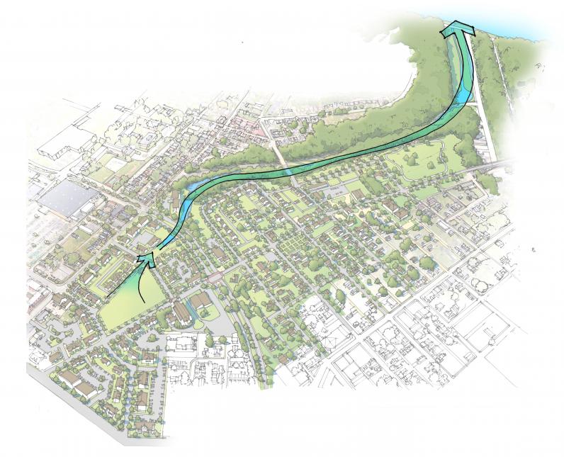 Image of Little Negley Run from the 2016 Larimer Neighborhood Conceptual Community Stormwater Management Plan
Find Your Sewershed
A sewershed is an area of land where water flows to a single endpoint.
Using the image of Little Negley Run as an example, it is a historic stream that roughly follows Negley Run and Washington boulevards. Water flowing through this area leads to the Allegheny River and discharges at the 42nd outfall along the river, as counted from the Point in downtown.
Little Negley Run is part of the Negley Run Sewershed - often referred to as the A-42 Sewershed. It encompasses several of Pittsburgh's eastern neighborhoods, including East Liberty, East Hills, Larimer, Lincoln-Lemington-Belmar, Highland Park, Homewood, Shadyside, and Squirrel Hill.
In Pittsburgh, sewersheds are an essential concept to understand when you think about how we manage stormwater. Most of the rain that falls in Pittsburgh enters our combined sewer system, which carries rainwater and wastewater through the same pipe. When it rains hard, these pipes often overflow into our rivers.
To understand which sewershed you live in and how it contributes to sewage overflowing into our rivers, follow these steps:
- Enter your address or zoom to your location on the Find Your Sewershed Map below or the full-size version.
- Click on the blue or green background to select your sewershed, then zoom out to view your sewershed’s shape.
- The pop-up information box shows you the sewershed name and whether it is in a combined ("C") or separated ("S") sewershed.
- If your address is in a combined sewershed, additional facts about the sewershed, like the typical number of combined sewer overflow events a year and the downstream point of connection, may be available.
- To see which parts of the city generate the most overflow volume in a typical year, navigate to the legend in the top left corner and check the Priority Sewershed box.